Thursday, June 28, 2012

detail 1


PHOTOGRAPHER'S JOURNAL: What units measure my distance from the people who built these terraces? How do I weigh the gap? How far are they, am I, from the hovering walls of the dark gorge?  A visit here is a sublime assault of spiritual vertigo. They tell me it's just the altitude, but I believe it's a matter of scale and proximity and forces we lack the tools to plumb. 

The dark monolith in the center of the image, just behind the watchman's tower, is the sheer face of a mountain cliff. Trees cling to the cliff and you can just make out a flag on a pole at the top. In reality it would stand tall next to the watchman's tower. The distance between is deceptive, the distance down, too far to fall. The Urubamba River swirls there for several million years, and smaller than a sparrow; my time at the top, too short to note.

This image is a detail extracted from yesterday's panorama. Look at the previous image to see where it fits. With time to stroll, I'd climb up and down the terraces walking back and forth, framing images with my long lens, ecstatic with vertigo, watching how the guard tower danced with the mountain peak between the garden terraces and the mountain walls, till the sun dropped, and the gorges were sealed.


Monday, June 25, 2012

At the Knob of the Knot


PHOTOGRAPHER'S JOURNAL:  Some years ago, attending a photo workshop in Nova Scotia, the leader's challenge was to make an "original" photograph of a lighthouse. We all understood his assignment. Lighthouses are iconic, especially along the northern Atlantic Coast. They are washed with salt air, barnacles, yellow slickers and mythology, just as they are surrounded by rocks, breakers, a horizon and are often limited in the number of natural photographic perspectives. As photographs, lighthouses come almost ready-made. Many have been frequently and well-photographed, sometimes with rare winds passing and memorable water. Our assignment was to find something new, something to make the viewer look at the lighthouse in a new way or to rediscover the icon as if for the first time.

As it turns out, the lighthouse we were to shoot was the much photographed one at Peggy's Cove. If you have in your mind an image of an old, Yankee, fishing village, there's a good chance your image is Peggy's Cove. It's not only iconic but singular. Movies have been filmed there. Everyone who arrives with a camera takes the shot from the head of the cove with the fishing boats docked along the left side by piers and related fishing shacks; houses clustered on the rocks behind, and beside the mysterious gateway leading to the sea. People stand at the head of the harbor and try to shoot that view even at times of day when the sun makes it almost impossible. Everyone following the only road into Peggy's Cove reaches that spot that looks as if the whole village had been composed around it, singular, unique.  They take a picture, and most are happy to have it as a document to help remember when they stood there.

At Machu Picchu everyone stops to photograph at the Watchman's Tower. That was the first view an ancient Incan would have has as well. Should we be surprised such master builders made sure it was a picture? However, the classic shot should include the tower; one begins to climb and scramble for angles from farther up and west.  Ramiro led us around the terrace steps to an area he had found, and I thank him for this guidance.

Such places are a dilemma for the photographer who arrives when the weather is ordinary, doesn't want to take the same, old, tired shot but who may have an audience who will be disappointed if he fails to record the singular view. Once he has taken that shot, he is free to photograph anything. 

However, if he has arrived at a place that has filled his dreams, it will not let him alone. He craves to experience its singular presence, to hear, smell, taste its music. This was what drew him on his pilgrimage, and he will want to make an image that attempts to communicate some part of what he is feeling even if the effort is doomed to failure.


Friday, June 22, 2012

Rio Urubamba


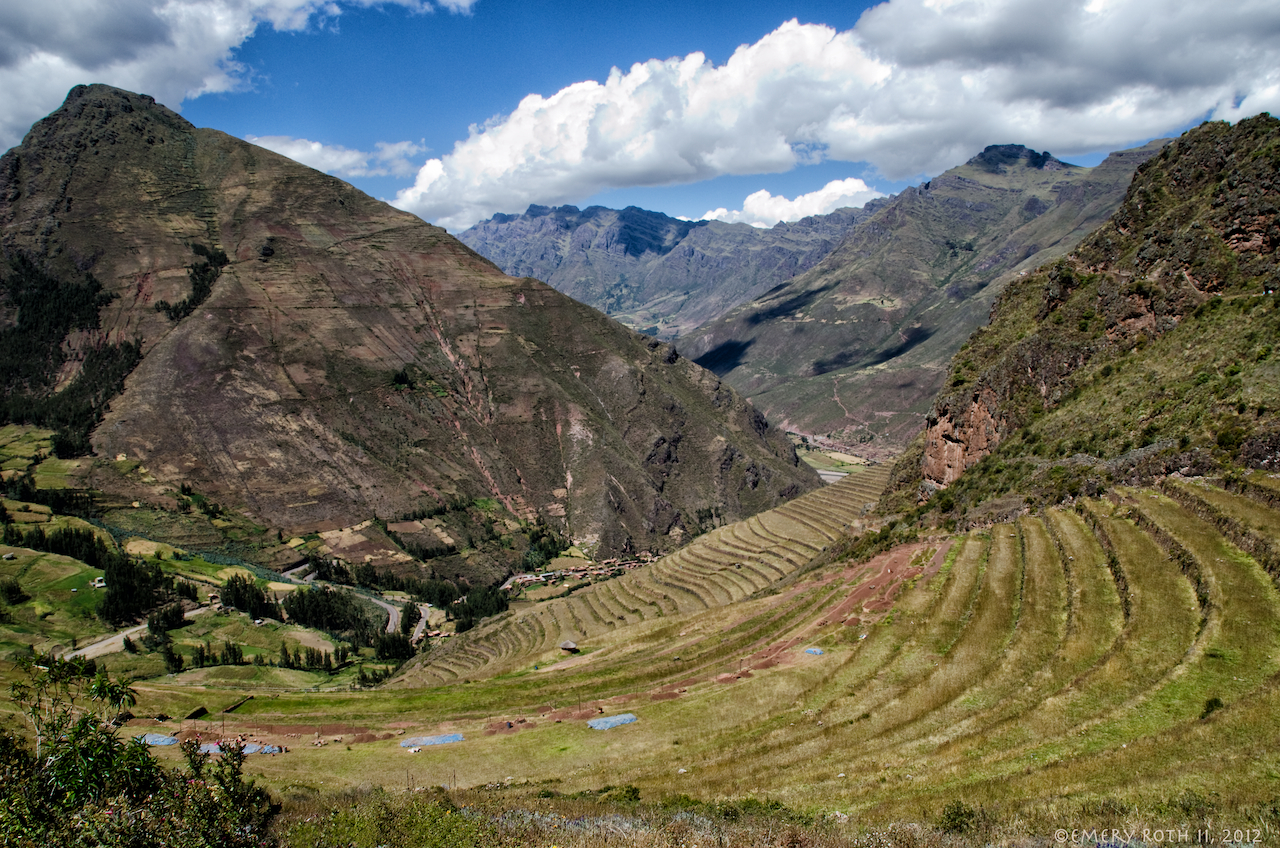
PHOTOGRAPHER'S JOURNAL:  Our train follows the Urubamba River from Ollantaytambo to the end of the track in Aguas Calientes, directly beneath Machu Picchu.  Between Pisac and Ollantaytombo the Urubamba River and its broad banks are gracious and hospitable.  Its waters fall slowly, in 35 miles, just 640 feet or about 18.3 feet per mile. Its surface is almost always smooth, fish are plentiful, the livin' is easy.  Between Ollantaytambo and Aguas Calientes, a distance of 18 miles, Rio Urubamba falls 2,970 feet or 165 feet every mile. It is always churning. 

As the river cuts its way deep into the mountains it winds like a snake and the canyon gets ever narrower. A couple of miles out of Ollantaytambo a foot bridge is suspended over the foaming river. Those who go by foot will cross the bridge and climb out of the canyon to follow the old Inca Trail over the mountains and past ancient fortresses and sanctuaries that have for centuries populated this wilderness where massifs collide. Those following the trail from here will require at least 4 days. 

Until the track was laid in the 1920s, passage up the valley was strenuous, the swirling river, perilous. Seven winding miles further down the gorge the vegetation starts to change; temperatures are warmer. The river and train track have dropped 1000 feet; this is the edge of the jungle.  Before Bingham, this was a trek only for the most rugged of missionaries; adventurers eyed it only as a prospect.

Further on, the serpentine river slides by the ruins of Choquesuysuy. Nearby at Chachabamba is another access point to the Inca Trail. Those who climb over the mountain from here can be at Machu Picchu in six hours. The train will be in Aguas Calientes in a dozen minutes. 

We have wound our way into the center of a knot. We are in a region where the river rages, and the mountains rise almost vertically around it, and we feel as if when the train finally stops, it does so because it can penetrate no further. Aguas Calientes is a dense cluster of rickety-looking, mud block buildings, piled 3 or 4 stories high and crammed in where two more rivers tumble from gorges into the Urubamba chasm. 

The town lies within spitting distance of Machu Picchu so long as one spits from Machu Picchu, several thousand feet above us.  Buses carry tourists up and (more terrifyingly) down the tortuous, "Hiram Bingham Highway,"  comprised of 14 narrow, dirt switchbacks up the cliff wall to Machu Picchu. When Hiram Bingham got here, there was no "highway."  

Trains, buses, rushing water, and the constant movement of tourists make Aguas Calientes feel as if it is choked with traffic, this town, deep in a knot of mountains where no road reaches.


Thursday, June 21, 2012

Beyond Ollantaytambo


PHOTOGRAPHER'S JOURNAL:   At 7 AM, Monday morning, we boarded one of only two daily trains to a place whose remoteness had kept it safely hidden from the conquistadors, from 400 years of adventurers, pilferers and desecrators, and from history itself from the fall of the Incas in the 16th century until 1910 when Hiram Bingham brought it to the attention of the outside world. 

How many of us had our childhood imaginations teased by stories of adventures in such places, visited them in books and movies, scaled the heights of Machu Picchu in seaside sandcastles or on actual mountains that were never like these?  Photographs have made Machu Picchu famous, and it is not only the spiritual world of the Incas that it has come to embody.

Remoteness had been the secret to Machu Picchu's survival. I imagined it covered in jungle as it was when Bingham first got there. Now Machu Picchu is Peru's most popular tourist attraction. There had been talk of a bridge, of roads. Ancient rocks had been relocated, and a helicopter had been landed, and I wondered if any of the magic could withstand the assault of 21st century tourism. I thought about the anachronism of 19th century technology through the inhospitable canyons in front of me that kept at bay the assault of more like me, and I secretly worried the magic might already be gone. Then the train was jolted into motion and rattled out of Ollantaytambo station.


Tuesday, June 19, 2012

Vistadome


PHOTOGRAPHER'S JOURNAL: The road through the Sacred Valley ends at Ollantaytambo. The only way to continue to Machu Picchu is by rail, hoof, or foot. Our time was limited. We chose VIstadome.

Sunday, June 17, 2012

The Authentic Photo


PHOTOGRAPHER'S JOURNAL: I asked Ramiro to stop the car in the next small village along the road. Most places we went there were people waiting, often soliciting, to have their picture taken for a small coin. They had traveled to the places where tourists congregate in their costumes.  I have no objection to this and distributed coins for pictures at many points along our way, but I felt frustrated at not being able in the time we had to get behind the facade that is put up for us tourists. 

I never knew the name of this town. It was similar to many we had passed where mud brick shops and houses lined the main road and often a small grid of streets behind it. There were no costumed people soliciting for photographs at such places.  Together with Ramiro I walked down a narrow lane that intersected the main highway, part of the village grid such as it was. I looked for an interesting doorway, maybe a goat and some laundry hanging out. A slight incline, a gentle wind put the end of the street out of site. I looked for pictures but I couldn't help thinking of our car where Jane and the driver waited, of Ramiro at my side, of how utterly hopeless it was that I could concentrate with the clock ticking and the world waiting.

As we turned back, this woman carrying her groceries turned the corner and came toward us along the lane. When she reached us, I pointed at my camera and at her to let her know that I wanted to take her photograph. I had the coin ready, but Ramiro and the woman began speaking in Quechua and then the negotiation was concluded, and I took my "authentic" picture, and we returned to the car and drove on.

Thursday, June 14, 2012

Chinchero, With Walls and Towers Girdled Round


PHOTOGRAPHER'S JOURNAL:  Unlike most Incan villages, Chinchero was first destroyed by the Incas themselves in retreat to prevent the palaces here from falling into the hands of the invading conquistadors. By 1572 orders had been given for construction of the present day church. It is likely the date painted inside, 1607, marks its completion. It was only in the 1960s that the finely carved walls of the old Incan palace were discovered beneath, serving as foundation for the church.  When the church was constructed, the old palace walls had been filled to the level of the roof with soil brought from elsewhere. 

Chinchero is another of those places that begs for leisure. On the one hand, I want to walk every street, photograph every door and window detail, every mud brick with an interesting plant growing over it. On the other hand, I want to stand back, explore the spaces, capture the expansiveness of the plains and mountains here. It is an ideal place to stop and watch light transforming surfaces, remolding spaces, recollecting moods.


Tuesday, June 12, 2012

Town Meeting, Chinchero


PHOTOGRAPHER'S JOURNAL:  After the Pisac market we were bound for Chinchero. Our guidebook praised the authenticity of Chinchero's market. When Jane, wondering if we really wanted to spend more time in a market, asked the reason to go to Chinchero, Ramiro answered immediately, "the land," but the way he said it made clear he meant more than the landscape. Chinchero lies in a fertile plateau well above the Urubamba, and it felt generations away. 

By the time we got there, the market had pretty much broken up, and a town meeting was underway in the square in front of the 17th century church. We kept our distance, and I have no idea what they were deliberating. The town is built upon the walls and terraces of an Inca palace and has given little ground to 20th century conveniences. We walked along cobbled streets of mud houses  that periodically opened out to views over the hills and terraces, where the people raise livestock and grow potatoes, grains, and barley.  From the land they get food, clothing and shelter. For anything else there are the markets, and market day is a time of celebration. 

Once again I marveled at the clarity and precision with which water was led through the village infrastructure. The Inca ruins here are extensive but they have been incorporated into the existing town and, despite little material wealth in the town, my impression was of permanence and well-being. This is a place of deep roots.

Chinchero means, "rainbow," in Quechua, and I imagined the storms that blew through during the rainy season, how people living and working on the plains below the village must often have seen it over a rainbow.

SLIDE SHOW: First climb up through the terraces, fortifications and ceremonial towers over Pisac, then catch the excitement of the town on market day before finally heading into the hills and the idyllic village of Chinchero where the town meeting is underway.


Monday, June 11, 2012

Pisac Bartering


PHOTOGRAPHER'S JOURNAL: If bartering is the photo subject, there are at least 3 or 4 shots to be made here. Passing through the center of the market I felt the force of each moving through the photo frame and instinctively knew a picture might be composed, I stopped and snapped and as quickly, prices were set, decisions made, life moved on and the possibilities had dispersed like smoke into air. This is all that's granted to a passer-by who doesn't speak the language.

The young man in the middle, surrounded by his sacks of produce, who does not wear the native costume of his village - are their implications in his dress that I'm missing? To photograph here one must be ready to barter beans for corn.

Saturday, June 9, 2012

To Pisac to Market


PHOTOGRAPHER'S JOURNAL: Sunday is market day in Pisac. Back in the town at the bottom of the valley, I hurry after Jane - don't want to lose her - while trying to find compositions in the constantly shifting street traffic. This is the town the Spanish built to replace the one on the mountain which they had destroyed. Jane stops to admire some drums - gives me a moment to pause. I try to compose the ever advancing and receding parade, hope for the right colors, costumes, faces, try to find the magic moment that will lead the eye through the image as the people pass on their trajectories. And then the chase after Jane toward the market square continues.

 While exploring the ruins above us, we had seen how historically the town had controlled the traffic, how roads from the farms and villages of the Sacred Valley and from the rain forest deep in the Andean jungle and from Cuzco, the Inca capital, all met here. On Sunday the local population speaking quechua still comes here to barter goods in the market square. Something like that may have always gone on here. Sprawling around them now other local merchants sell goods for cash to tourists like us. In the streets around the market square the constituencies pass.

Friday, June 8, 2012

The Citadel at Pisac


PHOTOGRAPHER'S JOURNAL: As we climbed above the terraces we had not yet seen Machu Picchu, 60 or 70 miles downstream in the depths of the valley. I wondered if anything could really be more spectacular than this citadel. We wound through narrow passageways along one of many paths through dwellings and by fortifications and scaled the heights to altars of ritual and turrets of vigilance and to the, so called, hitching post of the sun which casts no shadows on the equinox. It was a glorious morning.

In retrospect, having now been to Machu Picchu, and without diminishing the beauty of this place at all, the ruins at Pisac are of the earth, even earthy. Machu Picchu is of another dimension entirely and more amazing for having been here first. Together, they are the tangible roots of those who dwell in the Urubamba Valley.

I found a particularly good discussion of the ruins at Pisac here: http://enperublog.com/2009/07/20/inca-pisaqa-the-ruins-of-pisac/. At the bottom of the page are particularly good images of the ruins.

Thursday, June 7, 2012

The Terrace Gardens of Pisac


PHOTOGRAPHER'S JOURNAL: The morning after our visit to Ollantaytambo we returned east up the Sacred Valley of the Incas, and I again marveled at the quiet Urubamba River that flowed so gently beside bountiful fields between such rough and stony peaks. With a moderate climate year round and natural defenses, it is easy to see why the Inca's and their descendants have considered it sacred.

All along the road through the valley I admired the neat terracing, "andeneria," that farmers have used here for 1000 years to channel the water, increase the harvest and conserve the soil. Here in Pisac, at the top of the valley, the terraces wrap with special grace up to ritual sites and a fortress that looks south over Pisac and across the Urubamba Valley but that also turns back, northeast through a dark gorge into the Andean jungle.

Sunday, June 3, 2012

Ollantaytambo


PHOTOGRAPHER'S JOURNAL: Our first day in the Sacred Valley took us from Cuzco to Ollantaytambo where the road through the Sacred Valley of the Inca's ends. When we arrived our guide, Ramiro, led us directly up to a spot in the Inca ruins, above the town. He knew that as we got higher we would feel the wind that is funneled through the valley where the canyons narrow and intersect. On the valley wall opposite and across town but not shown in this image are the large granaries where the Inca's stored their grain so that the wind could dry and preserve it safely where it might be needed.  Around us where we stood were the ruins where the Inca's, for a brief moment, turned back the Conquistadors.

 My guide book tells me that in Ollantaytambo the townspeople carry on traditions from Inca times. I would have liked a few hours at least to linger here. But for a few snapshots, the town and its people remain a mystery to me, but as we arrived the sun was already falling behind the steep-sided walls that funnel the winds, and more time here would have meant missing something elsewhere.

Travel photography is a rushed affair, and one is never at the right place when the light is right, but here in Ollantaytambo at least, the sun helped me tell the story of the valley winds.

To see more of day one in the Sacred Valley of the Incas, here is a slide show. It includes photos taken along the road, more photos of Ollantaytambo including the granaries, and photographs of a "camel farm" where they raise alpaca, llama, guanacos, and vicuñas and process, spin and weave the wool.


Friday, June 1, 2012

Inca Light


PHOTOGRAPHER'S JOURNAL:  The previous blog entry hinted at the powerful experience we had in the Larco Herrera Museum in Lima, Peru.  The photographs in the slide show, Inca Light," were all taken hand-held with available lighting in the museum. I've tried to allow the music and sequence to help me tell the story as I felt it. 


Be sure to turn up the volume and click into full screen mode after you start the slide show.  Resolution of the images has been reduced to permit web viewing.